Craig Terry, Waverley Camera Club, July 2009
What is Geotagging?
- In a photographic context, geotagging is the process of adding geographical identification (location) metadata to photos. This data usually consists of GPS latitude and longitude coordinates, though it can also include altitude and place names
- Also known as Geocoding
Why Geotag your photos?
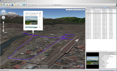
- Web Display – Google Earth, Panoramio
- Recording the image location
- Travel
- Documentation, eg Track Condition
- Commercial / Government, eg Asset Location- Real Estate
How to Geotag your photos
- Manually – Hand code or point/click on map (Panoramio, Google Earth…)
- Auto Geotag – Camera with built in or connected GPS Receiver
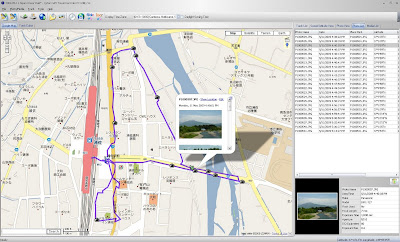
- Using GPS Log and software:
-If you are carrying a GPS unit, your data logger will know where you were located in a specific moment in time.
-By matching the timestamp of the photo with the GPS track point with the closest timestamp, you can geotag the photo.
-Software will do this automatically.A dedicated logging GPS such as Sony or QStarz or Multipurpose Hand Held GPS is suitable for logging travel for Geotagging. It must have track logging, computer interface, and long battery life.
QStarz BT-Q1000 Travel Logging GPS
- Compact, Self Contained, 100,000 points
- 32 Hours claimed battery life per charge
- Manual Memorise Button
- Included software for Geotagging, Viewing track logs, save to Google Earth format etc
- Mains and Car charger, standard Mini USB Port
- Approx AU $150 (July 2009)
Synchronising Software
- BreezeBrowser Pro – Breeze Systems – http://www.breezesys.com/
- Works with Sony LOG files
- Jet Photo Studio – http://www.jetphotosoft.com/web/home/
- Software is included with QStarz Travel Recorder http://www.qstarz.com/
In the Field:
- Set your camera clock accurately!- Use GPS time if possible
- Record your track with GPS Receiver- Place in car or carry so that it has a clear view of the sky- Check regularly that it is on and is receiving a signal
- Download Track Log to PC
- Geotag your images
- Display on the Web
References:
- Geotagging Photos Powerpoint by Steve Johnson, GISP, CPSWQ Engineering Specialist, City of Orem, srjohnson@orem.org
Steve’s Sources:
- An ABC of geotagging photos on the Mac at bioneural.net,
http://www.bioneural.net/2008/03/05/an-abc-of-geotagging-photos-on-the-mac/photos-on-the-mac/ - HOW TO GPS Tag Photos: Flickr, Mappr, Google Earth….
http://blog.makezine.com/archive/2005/07/how_to_gps_tag.htmlhtml - Panoramio’s Blog: Geocoding photos using any GPS
http://www.panoramio.com/blog/gps-camera-geocoding-photos/photos/
Other web sites:
Google Earth: http://earth.google.com/
Panoramio: http://www.panoramio.com/

